Unusually, I'm starting this ride without a definitive itinerary. It will start and finish in Los Angeles, and I'm allowing about 6 weeks for the trip. I'm hoping to fit in as many of the following as possible:
- sightseeing in LA
- the first few hundred miles of historic Route 66
- Lake Havasu City and Old London Bridge
- Las Vegas
- Hoover Dam
- Grand Canyon
- Death Valley
- San Francisco
- coastal route back to LA
Weather, and road conditions will play a large part in determining what progress I make and how much of these places I actually get time to visit. At any rate, barring injury, sickness, or a catastrophic mechanical breakdown, I should certainly have time to do everything on the list as far as the Grand Canyon. Provided that I don't spend too much time, or lose too much money, in Las Vegas.
As with last year's Cuba trip, I'm using a 1999 Raleigh Pioneer tourer which has proved tough and reliable, as well as comfortable, on previous long rides. I will be flying Virgin Atlantic and they have a generous policy of carrying bikes free, in addition to the normal 23kg baggage allowance.
Tuesday 26th April 2016
The journey to LA was uneventful. I purchased a cardboard bike box at Heathrow, packed up the bike and 10 hours later arrived at LA airport, where the immigration formalities were accompanied far quicker, and more courteously, than is usually the case when entering the US. It took a while to find a taxi big enough to carry the still boxed up bike - cars in the US are far smaller than they used to be.
I had booked a room for 2 nights at the Seaview Motel, close to Santa Monica Pier, the end of Route 66, from where I would start the ride east towards Las Vegas.

Wednesday 27th April
After reassembling the bike and checking it out thoroughly, I set off down the Marvin Braude coastal bike path, following it to its southernmost end at Redondo Beach, some 20 miles south of Santa Monica.


On the way back I stopped to admire the canal system at Venice:

Rope climbing at Muscle Beach:

Back in Santa Monica I then headed east towards Hollywood, riding along Hollywood Boulevard past the famous Mann's Chinese Theatre, which has the palm prints of many movie stars on the forecourt:

I returned part of the way back to the hotel by the metro system, which allows bikes on all trains:


Distance today 61 miles.
Thursday 28th April
I set off on the journey east towards Las Vegas, first taking a photo of the end marker of route 66, on Santa Monica Pier:
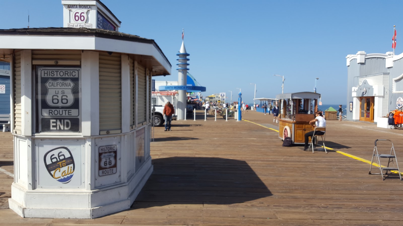
The fully loaded bike, with Santa Monica Pier in the background:

Despite its reputation as a car dominated city, LA has plenty of dedicated bike lanes, and even an electric bike hire scheme:

The picturesque streets of Beverley Hills are lined with tall palm trees:

Entering the downtown area of LA, some 14 miles inland from Santa Monica, I stopped to admire the Spanish Colonial style Union Station:

LA river, with Downtown area in the background:

There are plenty of signs to tell you what road you're on:

At Claremont the route joined the Pacific Electric Bike Trail, a cycleway along a disused railway line:

I reached San Bernadino around 7pm and stayed in the Wigwam motel, one of a chain of similar motels along Route 66:

Distance today 89 miles, total 150 miles
Friday 29th April
First stop was the McDonalds museum not far from where I had been staying, this is at the site of the first ever McDonalds restaurant. Unfortunately the original building was bulldozed, but the sign outside has been preserved:

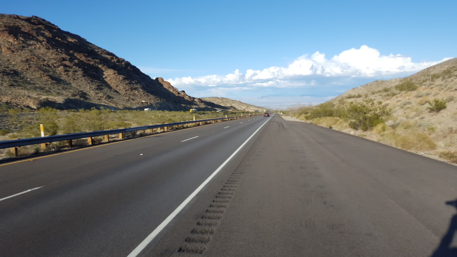
For most of its 2400 miles, Route 66 was a 2 lane highway, and this is a typical stretch.

Soon after leaving San Bernadino the road begins a steep 20 mile climb up to Cajon summit, at 4100 feet. This "ghost bike" was a timely reminder to take it easy on the downhills:

Halfway up to the summit the route joins Interstate 15, which had a wide shoulder and felt perfectly safe despite very heavy traffic:

Looking back downhill from Cajon Summit. Note the snow-covered mountain in the distance:

From the summit there was a lovely 20 mile downhill to Victorville, where I stopped to visit the Route 66 museum, which was full of interesting old photos and exhibits showing how busy and prosperous the town had been during the 40s and 50s heyday of Route 66 passing through it.

Historic roadside cafe outside Victorville:

I reached the day's destination, Barstow, at around 6pm. There were numerous motels lining the main street, however it wasn't hard to decide which one to stay in, as the Route 66 motel had a display of old cars, including a Metropolitan, dotted around the parking lot:


I had a good dinner at Rosita's, a Mexican restaurant nearby.
Distance today 82 miles, total 232 miles
Saturday 30th April
The weather was overcast most of the day and there was a bit of rain, but I managed to stay dry. Before leaving Barstow I visited another Route 66 museum there, housed in the historic station building:

Barstow Main St:

This billboard showed a positive messsage:

Not far from Barstow I met another cycle tourist going the same way, but much slower - he is riding the entire length of Route 66 on a BMX bike with small wheels and no gears! He brought the bike with him from Japan. I asked him why not get a touring bike with gears, he said that he just likes riding his BMX and isn't bothered about going any faster or making the journey easier!

After 25 miles I stopped for lunch at the famous Bagdad Cafe, a 1950s building which featured in the 1987 German movie of the same name. I haven't seen the film and don't know what it's about. The food wasn't bad, but it took ages to be served by the 150 year old waitress and I spent a lot longer there than I would have wished.

Abandoned gas station:

The road surface was really bad for the next 20 miles, which made for slow progress.

I arrived at Ludlow around 5pm and checked into the only motel. This is a ghost town, with just a gas station, motel, and cafe, and the cafe had already closed for the day:

Fortunately there was a Dairy Queen attached to the gas station so I was able to have dinner. Then spent an hour or two reading before getting an early night's sleep in preparation for a long slog tomorrow.
Distance today 55 miles, total 287 miles
Sunday 1st May
I knew I was in for a long hard day's riding, since there was no accommodation, and few services along Route 66 until Needles, over 100 miles away. I carried plenty of water and some food in case the services were closed on Sundays.
After about 20 miles I reached Amboy crater, a volcanic formation which had a trail leading up its side so you could look into the crater, which looked inviting but sadly I had to focus on getting to Needles before nightfall so reluctantly had to leave without doing the walk.

The railroad running alongside Route 66 had plenty of traffic, all freight trains some of which were very long. Consequently there was often a queue waiting at the level crossings along the route.

I stopped for refreshment at this cafe, which has a wonderful original neon sign:

A number of other restaurant buildings, now abandoned, were evidence of how busy this road had been in its heyday.


Commemorative marker:

After about 70 miles I came to this detour. Someone in a pickup truck told me that I would make it through okay on my bike so I decided to chance it rather than taking the diversion which looked like it would add several miles to my journey.

5 miles further on, the reason for the road closure became apparent - a collapsed section of bridge which I bypassed easily enough:

Being the only person on this stretch of Route 66 offered the opportunity to take a selfie:

For the last 10 miles into Needles, the road became Interstate 40:
Arrival at Needles:

Distance today 104 miles, total 391 miles
Monday 2nd May
After 4 days in the saddle I was due for a rest from cycling. I wanted to visit Lake Havasu City, some 40 miles south of Needles, and from there I was heading up to Las Vegas to meet a friend who was already there. As time was tight, and I didn't particularly want to cycle both ways to Lake Havasu, I decided to hire a car for a couple of days, and use it to visit LHC then Vegas where I would drop it off.
The nearest car hire was in Bullhead City, some 20 miles north of Needles, so I rode up there, crossing the Colorado River into Arizona:


It didn't take long to get to the car hire office and I was soon on my way to Lake Havasu City, arriving around lunchtime. The main attraction there is Old London Bridge which was moved there in 1968-71:


I took a ferry across Lake Havasu to check out the Casino, which is on Native American land. The ferry was an impressive craft, but the casino wasn't very interesting, just a few slot machines.

There are some scenic walking trails around the lake, with these fake lighthouses dotted around:

Distance today 20 miles, total 411 miles
Tuesday 3rd May
I drove a few miles out of Lake Havasu City to the Special Activities and Recreation Area park, or SARA, and spent a couple of hours walking an interesting, but not particularly well signed, trail to a large crack in the rocks:


Note the rope in the above photo to help walkers descend down the steep rock face.
After a late lunch I headed back to Needles then proceded north along US-95 towards Las Vegas. Arriving at Henderson, about 10 miles outside LV, in the early evening I decided to stay there, at the comfortable Best Western Hotel:

Wednesday 4th May
After driving to Las Vegas airport to return the hire car, I cycled up the famous Las Vegas Strip:

After rendezvousing with my friend Noel, I checked into my hotel, in Downtown Las Vegas and, following a few hours on the poker tables, watched the evening light show performance on Fremont St:


Thursday 5th - Sunday 8th May
Spent a relaxing few days in Vegas, with no cycling apart from a couple of trips up and down the Las Vegas Boulevard, the "Strip" that connects the new resort casinos with downtown

ID parade lineup at the excellent Mob Museum - an exhibition about organised crime:

View from rooftop bar of the Rio, where we saw Penn and Teller:

Fremont St, downtown:

Monday 9th May
I left Las Vegas, riding east along Fremont St, the main downtown street, which becomes the Boulder Highway leading to Hoover Dam:

Passing through Henderson, where I'd stayed on my way to Vegas the previous week, I joined the River Mountain Loop trail, a superb scenic off road trail that bypassed Boulder City and took me almost all the way to Hoover Dam:

If you zoom in on this photo you can see Las Vegas in the distance - the Strip to the left, downtown on the right:

Bicycle sculpture adorning the trail:

Approaching Lake Mead the bike path doubles up as a flood drainage channel:

I arrived at Hoover Dam in time for the last tour of the day, at 3.45pm. Since 9/11 a lot of the dam workings have been off limits to visitors but we were still able to see the generator turbines, and to access various viewpoints over the impressive dam structure:


I stayed in the nearby Hoover Dam Lodge, a large casino hotel which was virtually empty, and enjoyed a very good steak in the restaurant there:

Distance today 40 miles, total 451 miles
Tuesday 10th May
The entire day was spent travelling south on US 93, a highway originally built in the 1930s to supply the Hoover Dam workings, and which has been recently upgraded into a wide dual carriageway. There wasn't much to see on the way, apart from glimpses of the Colorado River:

- and one or two gas stations:

On the approach to Kingman there was a tough climb over the Coyote Pass:


Distance today 75 miles, total 526 miles
Wednesday 11th May
Before leaving Kingman I stopped at the visitors centre and was given a free entrance to their Route 66 museum, which had some interesting displays about the Arizona section of the "mother road":

The section of Route 66 heading east from Kingman is the longest continuous section of the old road still intact, stretching over 100 miles to Ash Fork. It's also uphill almost all the way so it was another tough day's riding and progress was slow in the heat.
Several historic cafes are still open along this stretch, all of which are filled with Route 66 memorabilia and old photos, and some have displays of old cars outside:


Still a long way to go to the Grand Canyon:

Just before Peach Springs I met an Italian cyclist coming from the opposite direction - he'd started in Chicago a month ago. We spent some time swapping our experiences and observations of the route.

It was nearing 6pm when I reached the Grand Canyon Caverns where there is a motel, and I decided to stop there for the night rather than pressing on to Seligman, another 25 uphill milles away. Among the old cars parked outside was another Metropolitan!


Distance today 66 miles, total 592 miles
Thursday 12th May
Before setting off on another day of almost continuous climbing, I spent an hour doing a tour of the caverns close to where I had been staying. The tour starts with a descent of 210 feet below ground in an elevator. Unfortunately the tour guide forgot to switch the lights on so we did the whole tour illuminated only by torchlight - more atmospheric, but not good for taking photographs.
View of cave interior:

There is accommodation for up to 10 people inside the cavern. It would make for a very atmospheric night's stay.

- During the Cuban Missile Crisis of 1962, the cave was deployed as an air raid shelter, and supplies of food and drinking water were stored inside, they have remained there unused ever since.

It was a very warm day on the road but this sign showed that despite being only 35 degrees north of the equator, the >5000 foot altitude meant that the road was prone to freezing during winter:

After 25 miles I arrived at Seligman, where the original idea to reincarnate old Route 66 into a "Historic Route" was conceived. Virtually every shop in town sells Route 66 items and memorabilia.


This was a bold claim to make, but having eaten lunch here I can confirm that the burgers are pretty good:

After Seligman the road narrowed, but also became much less busy. Interstate 40 runs very close to this section of Route 66:

Freight train disappearing off into the distance:

Elevation marker seen shortly after Seligman:

At Ash Fork, Route 66 (the small road leading diagonally in from the right of this picture) joins Interstate 40, the segregated carriageways of which are on the left:

It was 7pm, and night was approaching fast, by the time I reached Williams. It had been a very tough day. I just missed seeing the daily staged gunfight that takes place on the main street every evening.

The Arizona Motor Hotel, where I stayed in Williams:

Distance today 70 miles, total 662 miles
Friday 13th May
Before leaving Williams I had a brief ride around this attractive small town, which had a definite "Wild West" feel about it.
This historic train runs to the Grand Canyon daily:

Williams main street. This was the last town on Route 66 to be bypassed by the Interstate, in 1984:

The route to the Canyon from Williams is along Arizona Highway 64 It was a welcome change to actually have some good long downhill stretches, for the first time since leaving Vegas:

The route passed Bedrock, a Flintstones theme park. Tempting though the Brontosaurus burgers were, I pressed on without stopping, as I had no accommodation booked at the Canyon and was concerned that it may be difficult to find somewhere to stay. Accommodation there gets booked up months in advance and I'd looked at various booking websites in vain.

Around 1pm I arrived in Tusayan, a small town 7 miles from Grand Canyon Village, and saw a sign showing vacancy at the aptly named 7 Mile Lodge motel, so I checked in there...

...and rode on to the Canyon Village, where I got my first view of the canyon.

I rode over to the visitors centre, watched a short film about the canyon, then walked to Mather Point, one of the most popular viewpoints on the South Rim:


It was a breathtaking view, and I was really excited to have finally seen the Grand Canyon, which had been on my list for many years. But for now it was time to go back to the motel, shower and have dinner, exploring the canyon can wait until tomorrow.
The free bus shuttle serving Tusayan had a bike rack on the front, so it seemed silly not to make use of it on the 7 mile journey back to the motel:

Distance today 66 miles, total 728 miles
Saturday 14th May
I caught the first shuttle bus to the canyon, which left at 8am, and was at the Bright Angel Trailhead, starting point of the most popular hiking route into the canyon, by 9.15.
At the trailhead this sign gives some useful information, and warnings about dangers on the trail. It is 7.8 miles, and a 4500 foot descent to reach the Colorado River:

Bright Angel trail viewed from the South Rim:

The trail goes through 2 arches cut into the rock, early on the way down:

It then leads along a natural fault line, and zigzags around a lot, but is always easy to follow:

There are signs advising against trying to walk to the river and back in a day, but I wasn't deterred by them, neither were a number of other hikers:

Looking back up towards the rim. This view was taken from Indian Garden, half way down, which has a good water supply and hence relatively lush vegetation. This area was farmed by native Americans prior to white settlement.

Plenty of cacti grow along the trail:


I reached the Colorado River at 1.15pm, exactly 4 hours after leaving the South Rim. There were several inflatable boats white water rafting. I didn't stop there long because I thought it would take much longer to walk back up than it had taken to descend, and I didn't want to arrive back after dark.


On the way back up:

In the event I made very good progress on the return journey and arrived back at the South Rim at 5pm, having covered 15.4 miles. Surprisingly I had taken less time on the ascent than I had on the descent, mainly because I had stopped to take more photos on the way down.

I stopped at the El Tovar Hotel, a historic establishment built in 1905, for a celebratory drink, then headed back to Tusayan on the bus for a shower and a well earned dinner, which was at the Big E steakhouse.

Sunday 15th May
After yesterday's tough hike I decided to take it a bit easier today. I got the shuttle bus to the rim around 11am and headed for the South Kaibab trailhead, start of the other main trail from the South Rim down to the river.
View taken at the start of the South Kaibab trail:

The South Kaibab is much steeper, and rougher, than the Bright Angel trail. Also, unlike the Bright Angel, it has no drinking water supplies.

Mule transport is an option for those who don't want to walk:

At the aptly named OohAah point, about a mile down from the rim:

This section of the trail was very rough:

This is the vew from Cedar Ridge, 1.5 miles from the rim; this was as far down as I went:

On the way back up. The trail can be seen zig-zagging up the facing wall:

Back at the surface, I took the shuttle bus heading west to various points along the south rim, getting off occasionally and walking the rim trail. There's always another bus every 10 minutes.
View back towards Canyon Village, with Bright Angel trail clearly visible:

View down to Colorado River:

Sunset over the Canyon:

Monday 16th May
The weather had turned much cooler and it rained sporadically throughout the morning. Before leaving Tusayan I saw the IMAX film "Secrets of the Canyon" at the visitor centre, which was pretty good.
Because it was still wet, I made use of the shuttle bus again to carry my bike and luggage up to the Canyon Visitor Centre. I then rode the short distance over to the village, along the scenic bike trail:

Following lunch at the Bright Angel Lodge, I took a few final photos from the Rim trail:


The canyon certainly lived up to my expectations, it is a stunningly beautiful area and I would love to return one day and hike across to the North Rim.
But it was now time to board the bus back to Las Vegas, a journey of 5 hours. The bike fitted easily in the underneath storage compartment, I didn't even need to remove the front wheel. Arrived back in Vegas at 9pm and checked into a motel just off the strip, in time to get in a couple of hours of poker at the Linq casino before it got too late.
Tuesday 17th May
It was very cloudy when I awoke at 7.30 am and rain was clearly on the way. Undaunted I set off heading west on the next leg of the ride, which will take me through Death Valley, to Lone Pine where I'm hoping to climb at least part of Mt Whitney, the highest peak in the lower 48 states.
After about 4 miles riding down the Las Vegas Boulevard, aka "The Strip", which is certainly not the safest of roads to cycle on, I was relieved to turn off on SR160, which had a decent bike lane, towards the hills:

It then started to rain, not very heavily, but steadily. It was warm enough though for the rain not to be particularly troublesome. More of a problem was the lack of visibility which detracted from the scenic views. The tall buildings of Las Vegas can only dimly be made out in this photo:

It was a steady climb up to around 5000 feet, but the gradient wasn't too steep:

It was pretty cold at the top. In this bikers bar, where I stopped for lunch, I was grateful for an open fire burning inside. What a contrast from the heat of Las Vegas where I'd been a few hours previously.

It was then a steady descent towards Pahrump, the day's destination. This view shows snow-capped Mt Charleston, and in the foreground is a Joshua tree.

In Pahrump, back down to 2500 feet aboe sea level, it was nice and warm again, and the sun had even come out by the time I reached the Saddle West casino hotel where I checked in for the night:


In the evening I checked out the poker game at the Pahrump Nugget casino but unfortunately the game ended early, around 9.30pm, just as I was getting a feel for the table. At least it meant I could get an early night and be ready for tomorrow's journey into Death Valley.
Distance today 57 miles, total 785 miles
Wednesday 18th May
It was a warm sunny day, a welcome change from yesterday's gloomy weather. Leaving Pahrump a number of establishments claimed to be the last stop before Death Valley:

The road had no shoulder, but traffic was scarce so it felt quite safe. I met another cycle tourist coming from the opposite direction, and we stopped for a chat:

After about 30 miles I arrived at Death Valley Junction, a former mining town now occupied solely by the Amargosa Opera House and Hotel:


I would have considered staying there if there'd been a performance scheduled for that afternoon or evening but there wasn't, so I carried on into the Valley of Death:


It was a steady, gentle descent towards Furnace Creek, the next settlement. Near there I passed by Zabriskie Point, site of a former borax mine, where there was a lookout over the strange folded landscape:


A few miles on I came to the Furnace Creek Inn, which looked like a great place to stop for a meal, but it was closed for renovation. However about a mile further on was the Furnace Creek Ranch, 190 feet below seal level and the site of the hottest temperature ever recorded:


I stopped for a while and had some lunch, then called in briefly at the nearby visitor centre, where the outside thermometer read 108 degrees, somewhat less than the 119 that had been the reading on the gauge at Furnace Creek, but still hotter than most sensible people would want to cycle in:

Crossing Death Valley:

Ominous looking mountain range ahead, which will have to be scaled tomorrow:

Sand Dunes and mountains:

I reached the next habitation, Stovepipe Wells, at around 7pm and stayed in the very comfortable motel there:

Distance today 87 miles. total 862 miles
Thursday 19th May
I knew in advance that this was going to be a tough day, having looked at the route profile on Google Maps. And the receptionist at the Stovepipe Wells motel confirmed that I had a 20 mile uphill climb ahead of me.
And by the time I was ready to leave, at 7.30am, the temperature had already reached 80 degrees:

The climb began immediately. This was the view looking back towards Stovepipe Wells, with Death Valley in the background:

This recumbent cyclist from the Czech Republic was on his way down the hill, that's why he looked so happy:

1000 feet up, looking back again towards Death Valley:

The ascent went on getting steeper:

After about 5 hours at an average speed of around 4mph, I finally made it to the summit at Towne Pass, having climbed nearly a mile vertically:

I'd been looking forward to what should have been an enjoyable downhill blast into the Panamint Valley, but the fierce crosswind made it unsafe to exceed more than about 25mph. And even from the top, I could see that the wind was blowing up a big dust storm down below:


I had to ride across Panamint Valley with my eyes virtually shut, despite wearing large sunglasses, the dust was going everywhere and was blasting my face and arms quite painfully. But there was nowhere to shelter, I just had to press on until, at the other side of the valley, I reached Panamint Springs resort:

This was a much more basic establishment than Stovepipe Wells, with very few facilities, not even a TV and certainly no internet. The restaurant was okay, but annoyingly it wasn't possible to turn off the noisy airconditoning in my room and so I didn't sleep all that well, despite being very tired from the hard day's climb.
.
Distance today only 31 miles, but still the toughest day so far. Total 893 miles.
Friday 20th May
There was another big climb at the start of the day. Panamint Springs is at around 2000 feet above sea level and the route climbed to about 4500 feet, somewhat less than yesterday's brutal ascent. And, since I was starting from a higher elevation, it was much cooler.
Looking back over Panamint Valley

It was about a 12 mile climb to the top, from where I got my first view of the Sierra Nevada mountains:

At the tiny town of Keeler, this former gas station was now someone's home:

The descent into the Owens Valley was just as dust blown as the Panamint Valley had been, and by the time I reached Lone Pine, the day's destination, my eyes were full of debris which took a while to wash out.
The Best Western motel, Lone Pine, where I had a comfortable stay

Lone Pine is an attractive small town, at the foot of both the Sierra Nevada mountains and also the Alabama Hills, the scene of numerous film settings.
After lunch I took a look around the Movie History museum, which displayed posters and artifacts from many of the films that were shot here. Notable pictures made here include Bad Day at Black Rock, High Sierra, How the West was won, and countless other Westerns.


Lone Pine Main Street. The white building is the historic Dow Hotel, where many famous movie stars have stayed while filming on location nearby.

This relief map, which is in the Lone Pine visitor centre, shows the route I've taken from Las Vegas, with all the places I stayed circled in red. It gives some idea of just how tough the last few days have been.

Distance today 55 miles, total 948 miles
Saturday 21st May
I wanted to take a look around some of the film locations in the Alabama Hills, which involved a steep 4 mile climb out of Lone Pine along Whitney Portal Road, named after Mt Whitney, at 14500 feet the highest peak in the lower 48 states.
Alabama Hills in the foreground, Sierra Nevada mountains in the background:

At the turnoff to the film locations, along Movie Road, is this commemorative plaque:

I had an enjoyable couple of hours wandering around the various walking trails taking in the beautiful scenery. It was easy to see why film makers found this area, just a few hours drive from Hollywood, such a good location to film action scenes:


Afterwards I rode back to the visitor centre and obtained a day pass allowing access to the Mt Whitney trail tomorrow. Although I'd had a vague intention of trying to reach the summit, having arrived here I now know that isn't going to be possible; at this time of year there is still extensive snow coverage above 12000 feet and I don't have proper waterproof hiking boots or any mountain clothing. And you need an ice axe and crampons as well to make it to the summit at this time of year. So I will just content myself with walking up as far as I reasonably can.
This is the permit that you have to have to access Mt Whitney:

Distance cycled today 15 miles, total 963 miles.
Sunday 22nd May
It was a beautiful warm sunny day, perfect weather for a walk up Mt Whitney. But first I had to get from Lone Pine (altitude 3700 ft) to the trailhead which is at 8500 ft and 12 miles up Whitney Portal Road. Yes I could have ridden up but that would have taken about 4 hours and left me in no state to do any walking afterwards. Fortunately I managed to hitch a lift fairly easily and was at the trailhead by 10am.

After having to go through the process of obtaining the permit to access the trail, I was surprised to find that no checks were made at the trailhead to see that everyone had one. So I needn't have bothered!
The first few miles of the trail were snow free and easy to follow:

There were a few streams to cross:

Above 10000 feet there's still a lot of snow around:

Mirror Lake:

The route became progressively steeper and more difficult to follow:

By this point everyone else on the trail had crampons so were able to take the direct route up the slope:

I reached Consultation Lake, still frozen over at nearly 12000 feet above sea level, at around 2.30pm and decided that was as far as I could go. I'd already had to walk across a lot of snow to get here and my trainers just weren't gripping at all. It would have been dangerous to proceed further, and in any case I had to get back down to the trailhead, and find someone willing to give me a lift back to Lone Pine, before nightfall.
I got a bit lost early on the way down and ended up on a very steep snow covered slope. Just as I thought I was going to slip and roll down, I had a stroke of luck - partially buried in the snow I found an abandoned walking pole. With this now at my disposal, the descent became much easier and I made quick progress across the snow.
Consultation Lake:

Looking back down over the Owens Valley. The Alabama Hills are in the middle of the picture:

I caught up with some hikers on the way down and got chatting to them. They kindly offered me a lift back from the trailhead down to Lone Pine. We reached the trailhead around 5.30pm, I donated the walking pole to the trailhead store, then was back down in Lone Pine enjoying a well-earned dinner half an hour later, after a strenuous but very enjoyable day's walking.
Monday 23rd May
It was time to move on to the next destination, Reno. The final stage of the cycling trip will be from San Francisco back to Los Angeles, along the Pacific Coast. I didn't have enough time left to cycle from Lone Pine to San Francisco, but fortunately there was a convenient bus leaving early in the morning which took me to Reno, from where there are frequent Greyhound services to San Francisco.
The journey from Lone Pine to Reno was about 250 miles and took 6 hours. My bike was easily stowed on the front rack:

Arriving in Reno I checked into the very comfortable and centrally located Silver Legacy casino, and following lunch, had a brief walk around this small town. There isn't a lot to see but it's a pleasant enough place:


This is the Truckee River which runs through the centre of Reno. Legend has it that people who'd gone there to get quickie divorces used to ceremonially throw their wedding rings into it:

It was then time to settle down for a nice long poker session at the Eldorado casino adjacent to where I was staying.
Tuesday 24th May
It was raining in the morning so I took the opportunity to visit the Harrah Automobile collection, which turned out to be probably the best car museum I've ever been to, and I have been to hundreds of them. Besides being very large, with over 400 cars on display, the cars are almost all very rare and valuable examples, beautifully displayed.


In the evening I attended a meeting of Northern Nevada Mensa which was an excellent meal at the Stone House restaurant. It was well attended, and a very enjoyable evening.


After the meal there was time for another couple of hours at the poker table before bedtime.
Wednesday 25th May
I'd booked a ticket for the Greyhound bus to San Francisco departing at 8.30 am. I had to be at the depot an hour beforehand because Greyhound insist that all bikes be boxed. They had bike boxes for sale, but the box turned out to be very small so I had to dismantle the bike to a greater degree than usual in order to fit it inside, which took a long time. What a contrast with the convenience of the previous bus where I'd just placed my bike onto the front rack.

I arrived in San Francisco around 1.30pm and it took nearly an hour to get the bike back together again and adjust everything properly. I rode to my hotel, the Opal on Van Ness St, dumped my luggage, then set off on a ride around the city:

Cycling in SF is pretty demanding. The traffic actually isn't too bad, but there are insanely steep hills everywhere and some of the surfaces leave much to be desired:

Of course I had to check out the steepest hill in the city, the famous Lombard St:

I then rode up Telegraph Hill to the Coit Tower, which was closing just as I arrived:

Then it was over to Fisherman's Wharf where I took a look around the Musee Mechanique, a collection of working antique amusement arcade machines:


Distance cycled 10 miles, total 973 miles
Thursday 26th May
I spent the day riding around the city. The hills are crazy, but at least I'd got plenty of hill-climbing practice in Death Valley last week. I first rode over to the Presidio, the large park by the Golden Gate Bridge, from where there are terrific views:


There were lots of cyclists and pedestrians crossing the bridge.

Over on the north side, I rode the loop around the Marin headland, which would have afforded some excellent views, but unfortunately it was becoming foggy, which happens very often here:


Having completed the 10 mile hilly loop around the headland I headed a few miles north to Sausalito for lunch. By now the fog had cleared and it was sunny again

There are lots of companies hiring out bikes in SF so people can ride over the bridge. They all come to Sausalito and find that there are tough regulations about where you can park bicycles:

After a good lunch at Sausalito I headed back uphill to the bridge, which was now clearly visible again:


On the way back to the hotel I detoured via various landmarks including:
Haight Ashbury - nothing much to see there:

The Castro theatre:

The Mission Dolores, oldest building in the city:

City Hall, scene of the famous shooting of Harvey Milk and Mayor Moscone in 1978:

Distance cycled today 34 miles, total 1007 miles
Friday 27th May
I wanted to visit Napa Valley to check out a few wineries. The town of Napa, the entrance to the valley is about 50 miles by road from San Francisco, so it wasn't practicable to cycle all the way there and back in a day. So I rode to the Ferry terminal at Embarcadero and caught the 8.15 ferry to Vallejo, on the north-eastern side of San Francisco Bay:

View of downtown SF from the ferry:

On arrival at Vallejo an hour later, I waited another half hour for the bus to Napa, which got me there around midday.
View of Napa river and downtown:

After a brief stop at the visitor centre to pick up a map, I headed north along the Silverado Trail, one of the roads that leads through Napa Valley. There are about 400 wineries in Napa so it's hard to choose which ones to visit in a limited time. I restricted myself to just 3 - Daioush, Clos du Val, and Robert Sinsky, all of which were in distinctive buildings in very attractive settings:
Darioush Wineery:

Clos du Val buildings shrouded in foliage:

Robert Sinsky winery:

The Silverado Trail had a good wide bike lane and the scenery along the route was excellent

Surprisingly, none of the wineries I visited offered any food. I was getting hungry by now so detoured into Yountville where I had a really nice gourmet burger at the R & D Kitchen, along with some more fine wine:

It was now time to head back to Napa. I arrived there around 4.30 and was in time to get the bus back to Vallejo for the 5.45 ferry back to San Francisco.
The wines I tasted were all very good quality and I was impressed by the opulence of the buildings and the beauty of the scenery. It would have been good to spend some time based in the valley which would have allowed time to visit a lot more than the 3 I managed, however at least I did get a taste of what this beautiful region has to offer.
Distance cycled today 25 miles, total 1032 miles
Saturday 28th May
It was another warm, sunny day. I started with a visit to the Cable car museum, a fascinating building which houses the machinery which keeps the iconic cable cars in motion:


I rode up to Coit Tower again, hoping to go to the top for a view across the city, but having struggled up Telegraph Hill, there was a long queue so I didn't bother to join it.
From there I rode west to the huge Golden Gate park, where I saw some skaters - the first I've seen in this most skate-unfriendly city.

I carried on to Ocean Beach and had a glass of wine at the Cliff House, a historic SF institution that has appeared in a number of films. It's been rebuilt several times and the current incarnation isn't a particularly distinctive building, but it does have great views over the ocean. It''s the white structure in the middle distance of this picture:

Looking south along the beach from the Cliff House:

Distance cycled today 15 miles, total 1047 miles
Sunday 29th May
It was time to leave San Francisco and head south along the Pacific Coast back to Los Angeles, the last leg of this tour. I knew from this route elevation profile, that there were a lot of hills to be climbed over the coming days. Indeed, it shows that between SF and LA there are no flat sections at all!

Being Sunday morning the city streets were quiet and it didn't take long to cycle the 5 miles out to the coast, arriving at the Cliff House where I'd been yesterday:

What a shame that the current incarnation of this building is so ugly, when previous versions were ornate and worthy of such a prominent site.
There was a stiff headwind to battle as I rode down the coast road:

There is surprisingly little suburban sprawl heading south from San Francisco, and within very few miles I was into sparsely inhabited countryside, the route passing close to the sea:

The approach to this tunnel was pretty treacherous - a long steep uphill along a busy road with virtually no shoulder. Still I made it through safely.

It was a holiday weekend, tomorrow being Memorial Day, so traffic was quite heavy. There were lots of beaches along the route, and despite the weather being overcast and quite cold, there were plenty of people on them.


For the last few miles into Santa Cruz, the weather brightened up, and I was pleased to get onto this nice scenic bike path:

Because of the holiday, all the motels were full and the only accommodation I could find was in this hostel which was actually quite comfortable:

There were lots of good restaurants to choose from nearby and I enjoyed a tasty sea bass at a place called Assembly.
Distance today 82 miles, total 1129 miles
Monday 30th May
Before leaving Santa Cruz I rode down to the seafront to take a look. It was a cold, misty morning and unsurprisingly there weren't many people on the beach:

These signs, which appear often along the route, do seem to have a beneficial effect, because drivers generally give cyclists plenty of passing space and it's very uncommon to encounter any aggression from them, unlike in the UK:

After about 30 miles I reached Monterey, via a good bike path running alongside the main Highway 1:

By Fisherman's wharf, the Custom House, dating back to 1814, is the oldest government building on the West Coast, and was the scene of the US takeover of California from Mexico. Monterey was then briefly the state capital:


Fishermans Wharf, Monterey
Negotiating the many steep climbs along this section of the route was hard work, and it was disappointing not to be able to enjoy the scenery very well owing to dense mist that persisted throughout the afternoon:


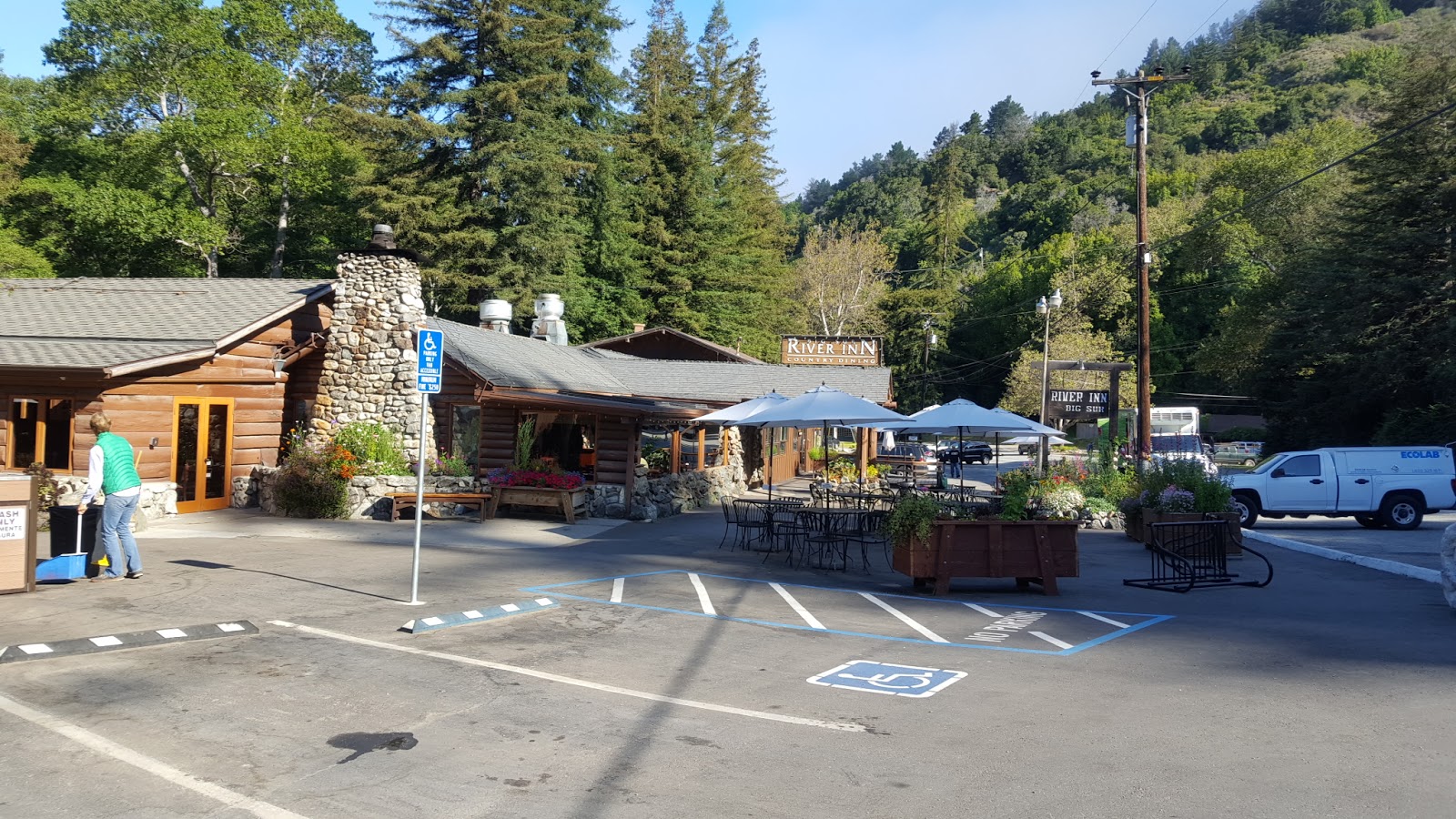
I stayed the night in the Big Sur River Inn:

Distance today 77 miles, total 1206 miles
Tuesday 31st May
It was sunny and warm early in the day as I was having breakfast at the River Inn:
But within a short time, the fog had returned, even more dense than the previous day:


At least it stayed dry. But it was frustrating, and disappointing, to battle so many big hills yet see so little in reward.
By lunchtime the visibility had improved somewhat:


Approaching San Simeon, the final destination for today, this beach had hundreds of basking elephant seals:


Distance today 71 miles, total 1277 miles
Wednesday 1st June
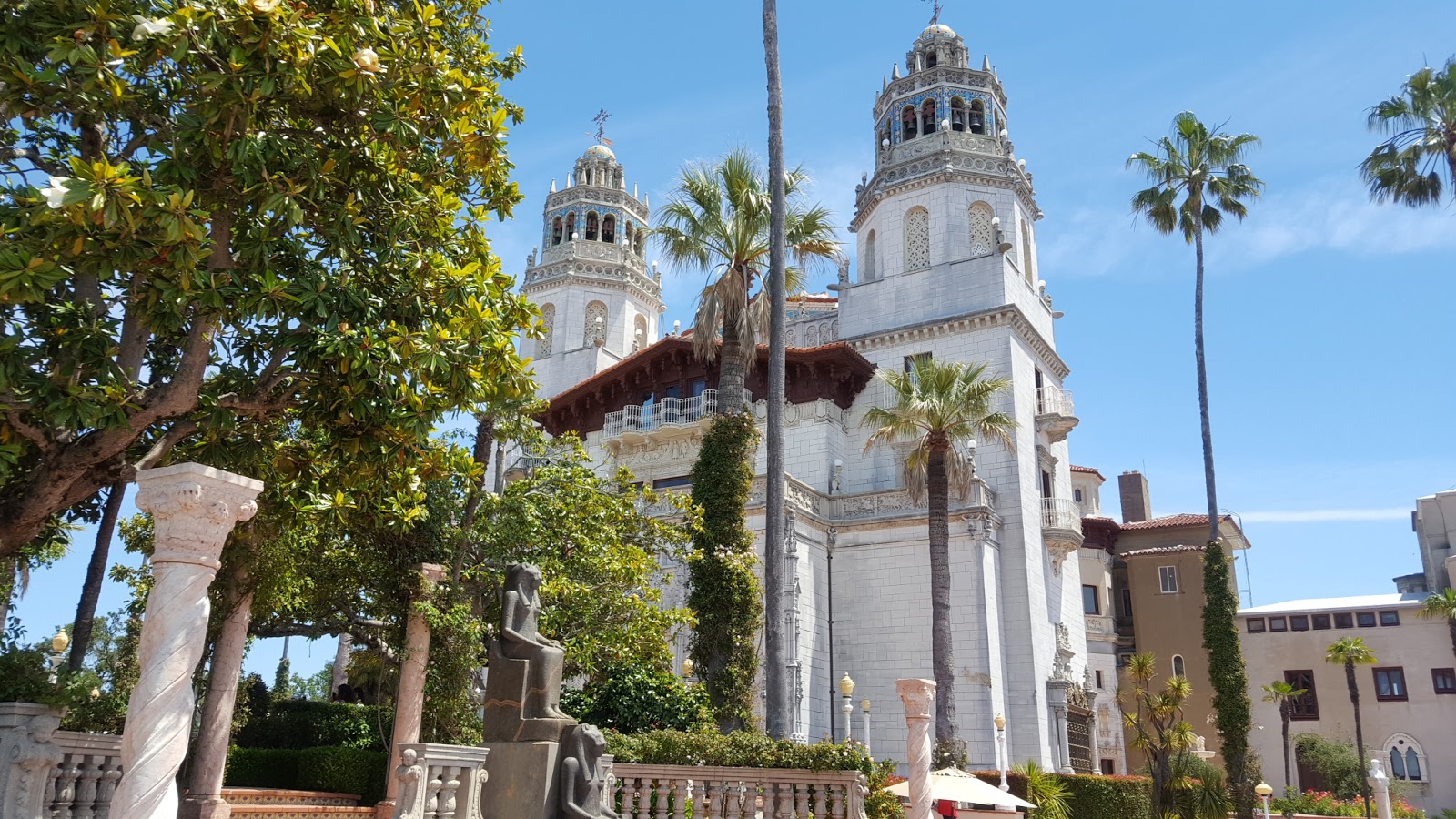
After breakfast at the motel in San Simeon I cycled 3 miles to the visitor centre at Hearst Castle, where I joined a tour of the estate. The huge castle, and the various associated buildings, are on top of a hill, 1600 feet above sea level, along a 5 mile long private road, and a fleet of buses takes visitors there from the visitor centre. First you get to see an IMAX film presentation about the Hearst family, and telling how the inspiration, and the funds for the massive undertaking of building the castle, and stocking it with masses of historical artifacts from all around the world, came about.

Probably the world's most photographed swimming pool, the Neptune Pool, has been empty for some time, owing to an ongoing drought in the region. Even without water it's pretty impressive:

(Incidentally the drought has caused the visitor centre toilets to be closed for over a year. The million-plus visitors per year all have to use a huge array of chemical toilets outside the visitor centre building.)
We were shown just a few of the over 100 rooms inside the huge Casa Grande; they were filled with antiquities, paintings, tapestries, sculptures and every conceivable form of fine art:


It's a very impressive place, and amazing that so many beautiful works of art could have been acquired by a single individual. Despite being from many different eras and countries, everything blends together seamlessly to form a coherent, beautiful environment, which was for many years the setting for numerous gatherings of all the most famous and influential people in the US.
Leaving San Simeon around midday I headed back south along highway 1; after another 15 miles the next stop was at Cayucos:

A few miles further on, Morro Bay is renowned for the large rock just offshore:

Then the route led through the Valley of the Bears - but fortunately I didn't encounter any:

I arrived at San Luis Obispo, the day's destination, around 6.30pm and checked into the Avenue Inn Downtown which was comfortable enough:

I walked around the compact town centre in the evening, it has many old buildings includng the original Catholic mission dating back to 1772:

... and a nice old cinema:

The centre has plenty of good restaurants, and the world's only "bubblegum wall" said to have over 2 million pieces of used gum stuck to its walls :

However these signs which appear on many buildings in the town centre, are a bit disconcerting:

Distance today 52 miles, total 1329 miles
Thursday 2nd June
The morning started sunny and warm, but by the time I reached Pismo Beach, about 10 miles from San Luis Obispo, it had turned decidedly overcast and a cold wind was blowing in from the Pacific Ocean:

A bit further on, at Oceano, the former station building has been nicely restored:

The weather gradually improved by the time I reached Guadelupe, where this large map mural showed a lot of the places I'd visited earlier in this tour:

By the time I reached the Purisima Hills and was faced with a 1000 foot steep climb, it had warmed up considerably:

But I've ridden up so many hills in the last few days that I found it no problem and was soon enjoying the view over the town of Lompoc lying below:

Entering Lompoc I found that it has a good network of bike paths:

After finding accommodation in a motel, I took a ride a few miles out of town to the La Purisima mission, another of the original 21 missions established in the 18th century and considerably larger than those in San Francisco and San Luis Obispo:


The bike path leading back to the city centre apparently has some dangerous wildlife, but I didn't see any:

Friday 3rd June
Leaving Lompoc I was confronted with a steep climb of about 750 feet over the Gaviota pass:


Once over this, the route rejoined the coastline and flattened out considerably. On the way into the town of Goleta I passed this ornate former gas station, built in 1928 and which was the setting for a 1980's remake of the film "The Postman always rings twice":

The route then joined a long bike path through a huge university campus leading into Santa Barbara. There were masses of people cycling, and several huge bicycle parking lots:


The weather then became foggy for a while, but brightened up again when I reached the main beach at Santa Barbara:


Santa Barbara seemed to be a very prosperous place with many attractive buildings, notably the City Hall, from which excellent views over the city can be had from its clock tower:


Leaving Santa Barbara the route continued along an attractive coastal bike path lined with tall palm trees:


Soon however a thick fog descended so I decided to stop for the day at Carpinteria, about 10 miles east of Santa Barbara.
Distance today 74 miles, total so far 1468 miles
Saturday 4th June
From Carpinteria the route south follows the shoreline mainly along Highway 1, with some sections on cycle paths. It was fairly flat all the way, but unfortunately also quite foggy most of the day:

I saw quite a few other cycle tourists along this section of the route:

At Ventura beach there were lost of surfers in the water, waiting to catch a wave:

At Point Mugu, by a naval airforce base, there was an interesting display of fighter aircraft and missiles:

Beach at Malibu:

It was around 7pm when I reached Santa Monica, and the pier came into view:

So I was back to where I'd started from, six weeks and over 1500 miles ago. But the trip isn't finished yet, I have 2 more days to enjoy Los Angeles!
Distance today 85 miles, total so far 1553 miles.
Sunday 5th June
I stayed in the Seaview Motel, one block back from the beach, the same place I stayed at when I arrived here 6 weeks ago. It seems like a lot longer. The motel owner had kindly stored my bike box and it was there ready to be reused for the return flight to London.
Since I was last here, a major event has taken place in Santa Monica - just 2 weeks ago a new extension to the metro system has been opened, and Santa Monica is now connected to the rest of the city via this new line.
Brand new station at downtown Santa Monica

I took the bike on the new metro line, all the way down to Long Beach for a look around the Queen Mary which has been berthed here as a floating hotel and museum since 1969:

The entry fee included an entertaining and informative tour, plus a self-guided audio tour and I spent several hours on board. It has been beautifully restored back to its original condition, and there are many historic exhibits and photographs on display.
Cocktail bar

This map of the Atlantic showed passengers the progress of the voyage, in the days long before everyone had GPS on their mobiles this must have seemed pretty impressive:

You get to explore the huge engine room:

... and even see one of the propellers, in a special watertight room built on the side of the ship.

On the journey back I stopped off at Watts, an area of south central LA notorious for gang warfare and riots, but safe enough during the day, to see the Watts Towers - a Gaudi-esque collection of structures built over 3 decades by an eccentric Italian immigrant, from pieces of scrap metal and broken ceramics that he found lying around. It's now on the heritage register and many people come to visit, but I was underwhelmed by it all.


I preferred this nearby mural:

Back in downtown LA I took a ride along Broadway where there are some significant historic buildings:

This theatre, which has a fabulously detailed facade, featured in the film Blade Runner:

Nearby is El Pueblo de Los Angeles, a collection of the oldest buildings in LA dating back to 1822:

From there it seemed fitting to visit the oldest restaurant in LA, Coles Pacific Electric Buffet, and enjoyed one of their speciality French Dip pastrami sandwiches. It was then time to head back to Santa Monica again.

Monday 6th June
I took the bike on the metro to Laurel Canyon, north of Hollywood, from where it was a short ride to the Metropolitan Pit Stop, which has a museum devoted to Metropolitans, featuring some very special unique cars.

This is the only Metropolitan estate car in existence, built as an experimental prototype:

This is the AstroGnome - a concept car built using Metropolitan engine and running gear, in 1956:


Incredible that this 60 year old car still looks futuristic!
I took the metro back a few stops to Hollywood and then rode a few miles up a very steep hill into Griffith Park, to visit the observatory, which has appeared in many films, most notably Rebel Without a Cause. Unfortunately it was closed, but I could still admire the handsome art deco exterior and also had good views over the city and the Hollywood sign, albeit somewhat obscured by smog:


In front of the Observatory is this memorial to various famous astronomers:


Then I rode back down the hill to Hollywood Boulevard, and got another train back to Santa Monica. There was just time for a final look at the beach there before getting a taxi van to carry myself plus the bike and the large box to the airport for the flight back to London:

Thanks for reading this blog, all comments are appreciated.